San Martin, CA land: flood, zoning and parcels
2,187 parcels
29% of San Martin’s 2,187 parcels are in a FEMA flood zone.
Map data Oct 11, 2026
- Acres on the roll6,751
- In a FEMA flood zone29%special flood hazard area
California 2026-27 taxes: bills go out by November 1; first installment due by December 10, 2026, second by April 12, 2027. Pay or check a bill at the Santa Clara County Department of Tax and Collections.
Free account: 25 parcel cards a day on the map, with watches and a saved search. Get started free
Around San Martin
Parcels to start with
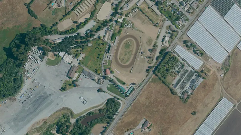
Flood zones and wetlands
Recorded flood claims in San Martin
Insured buildings in and around San Martin filed 29 flood claims since 1978; FEMA paid $276,000 on them.
- Fewer than 10 were on buildings rated outside the mapped flood zone (zone X, B or C)
| Years | Claims |
|---|---|
| 1978–79 | Fewer than 10 |
| 1980–89 | Fewer than 10 |
| 1990–99 | 12 |
| 2000–09 | Fewer than 10 |
| 2010–19 | Fewer than 10 |
| 2020–26 | Fewer than 10 |
What flood insurance costs in San Martin
In and around San Martin, insured single-family homes in an A zone (special flood hazard area) pay about $1,010–$1,910 a year for flood insurance.
| Flood zone | Policies | Middle half | Full-risk median |
|---|---|---|---|
| A zones (special flood hazard area) | 49 | $1,010–$1,910 | $1,790 |
| X zone (outside the mapped flood zone) | Fewer than 10 | Not shown | Not shown |
People and new homes in San Martin
About 6,954 people live in San Martin.
- Population6,9542020–2024 average, ±805
- Median household income$158,2502020–2024 average, ±$25,838
Typical lot sizeThe typical lot, from the roll
The median parcel in San Martin is 2.00 acres (2,187 parcels with a size).
Acres from the county roll, or from the parcel's own outline where the roll's figure is off by more than three times. Condominium units that share one point (each carrying the whole complex's acres) are left out of the lot sizes.
How San Martin is zonedThe most common districts
| Zoning district | Parcels | Share of zoned |
|---|---|---|
| RR-5Ac | 1,339 | 61% |
| RR-5Ac-sr | 247 | 11% |
| RR-5Ac-sm | 226 | 10% |
| A-20Ac | 201 | 9.2% |
| A-20Ac-sr | 84 | 3.8% |
| HS | 26 | 1.2% |
| RR-5Ac-sr-sm | 15 | 0.7% |
| AR | 13 | 0.6% |
Zoning is on file for 100% of parcels in San Martin, across 15 districts (the newest zoning map is dated Jul 2023; each parcel page gives its own map's date). A district shown by its code alone has no published name on our map. The town or county zoning office has the final word on any parcel.
Land parcels in San MartinFarm and timber parcels to start with
- 13.7 acres of land
- 13.6 acres of land
- 13905 Llagas Av 13.6 acres
- 13.6 acres of land
- 13.6 acres of land
- 13.4 acres of land
- 13.2 acres of land
- 13.0 acres of land
Farm parcels of an acre or more, each with its own page of public roll facts.
Nearby townsTowns around it
Questions about San Martin landAnswers from the public records
How many parcels are in San Martin, CA?
2,187 parcels on the Santa Clara County tax roll (as of Oct 2026) inside the Census Bureau's boundary for San Martin, which can differ from its own limits at the edges, covering 6,751 acres.
How much vacant land is in San Martin, CA?
Santa Clara County's tax roll codes little or no vacant land, so we do not count it here.
What is the typical lot size in San Martin?
The median parcel is 2.00 acres, from 2,187 parcels with a recorded size.
How much of San Martin is in a flood zone?
29% of parcels are in a FEMA special flood hazard area (National Flood Hazard Layer, as of Oct 2026). Check each parcel's own flood line before you buy.
Are there wetlands in San Martin?
0.4% of parcels are a quarter or more wetland on the USFWS National Wetlands Inventory, a mapping guide, not a legal delineation.
What is San Martin zoned?
Zoning is on file for 100% of parcels (zoning maps as of Jul 2023). The most common districts: RR-5Ac, RR-5Ac-sr, RR-5Ac-sm.
Are there land prices for San Martin?
No land-price range is shown for San Martin yet. We have no sale-price file for Santa Clara County yet.
How many people live in San Martin?
About 6,954 on average over 2020–2024 (Census American Community Survey 5-year).
Where does this data come from?
Parcels: County of Santa Clara. Flood: FEMA National Flood Hazard Layer. Wetlands: USFWS National Wetlands Inventory. Towns: U.S. Census places. Every figure is counted from those files on our map.
More in Santa Clara CountyIts other towns
Sources & methodSources, dates and how these figures are built
Property tax due dates
California Revenue and Taxation Code 2617, 2618, 2619 and 1603; the State Board of Equalization’s 2026 appeal filing periods. Checked Oct 13, 2026.
Recorded flood claims in San Martin
Area statistics for buildings with NFIP flood insurance, not any one parcel: a lot that never had an insured building has no claims to count. Claims counted from 1978 to Sep 2026.
Source: OpenFEMA NFIP Redacted Claims v3, as of Sep 2026.
What flood insurance costs in San Martin
Middle half: the middle half of premiums on single-family NFIP policies that took effect Sep 2025–Sep 2026, by the flood zone each policy is rated in. It is what insured homes here pay, not a quote for any one building.
Full-risk median: the median of FEMA's own full-risk premium for the same policies (Risk Rating 2.0). A discounted policy rises toward it a step each year, within the law's cap on yearly increases.
Source: OpenFEMA NFIP Redacted Policies v3, as of Sep 2026.
Counted in the 3 census block groups that lie mostly inside San Martin, so the edges may reach past the town line.
People and new homes in San Martin
U.S. Census Bureau, American Community Survey 2020-2024 5-year (B19013) (Jan 2026).
Sources
Parcels: County of Santa Clara (roll as of Oct 2026); flood: FEMA National Flood Hazard Layer (as of Oct 2026); wetlands: USFWS National Wetlands Inventory (as of Oct 2026); town limits: U.S. Census Bureau TIGER/Line places; counted on our map built Oct 2026.
This product uses the Federal Emergency Management Agency's OpenFEMA API, but is not endorsed by FEMA. The Federal Government or FEMA cannot vouch for the data or analyses derived from these data.