3.65-acre residential lot near Sellersburg, Clark County
Indiana Ave, Sellersburg, IN · Parcel 101708900204000031
2025 roll, county file September 2025 · before the 2026 roll
At a glance
- BuildZoning not on file
- GroundPublic sewer
- AccessFronts a public road
- ValueTax value $24.4k, 2025 roll · last sale $225k, Oct 2021
- Acres3.65
- Land typeVacancy not verifiedNo building found, September 2025
- ZoningWe have not collected a zoning map for Town of Sellersburg yet
- Flood zoneMostly in flood zone AE (59%)The rest: X, 0.2% annual chance (38%) and X (3%, minimal flood hazard) · FEMA flood map, as of Jul 2026
- Wetlands1% of the parcelUSFWS National Wetlands Inventory, as of Oct 2026
- Tax value (county)$24.4kAssessment, trended yearly; not a market price · 2025 roll
- Last sale$225k · Oct 2021
- Road accessHas road accessRoads: Census TIGER/Line 2025 roads with IndianaMap road centerlines, Feb 2026
- Road frontage917 ft on S Indiana Ave
- BuildingNone on the roll
- City or townSellersburg
- SewerConnectedPer the county assessor's record · 2025 roll
Land facts
From public records and official maps, each with its source and date.
- Who zones itTown of Sellersburg
- Septic (soils)Not rated (urban land)USDA NRCS soil survey (SSURGO), septic absorption fields; map unit: Urban land-Udarents, fragipan substratum, complex, till plain, 0 to 12 percent slopes · Oct 2026
- Ground elevationAbout 459–470 ft above sea level; average slope 3.3%USGS 3DEP 1/3 arc-second (about 10 m), NAVD88; about ±1–2 ft · Oct 2026
- HighwaysUS Hwy 31 is 151 ft away and I-65 interchange at State Rd 311 is 0.7 mi away, in a straight lineCensus TIGER/Line 2025 roads with IndianaMap road centerlines · Feb 2026
Services and surroundings
What serves the area around this parcel, from federal and state maps. Area facts, not a survey of the lot.
- USDA home loan areaInside an eligible areaHousehold income limits also apply. USDA Rural Development map, edited Jul 2023.
- Traffic countAbout 7,300 vehicles a dayUS 31: the 2024 average daily count for the road segment, not the driveway. Federal Highway Administration counts, 2024.
- Well depth nearbyMedian 58 ft (middle half 51–77 ft)From 14 well logs within 2 mi, drilled 1959–1966; water level 23 ft below ground; bedrock at 9 ft. Area figures, not this parcel. Indiana DNR well records.
- Public land nearbySilver Creek Township Park, 0.8 miCity land, open to the public. 44 acres. Being nearby does not give access or hunting rights. USGS protected areas map (PAD-US 4.1).
School district
Public federal records, each with its source and date.
- School districtSilver Creek School CorporationGrades pre-K–12 · NCES EDGE school district boundaries, school year 2024–25 (Census TIGER 2025 lines), released Mar 2026. A district, not an assigned school
District details at NCES: Silver Creek School Corporation
Utility service areas
Public service-area maps, each with its source and date. An area, not a connection at this parcel.
- Electric service areaInside the service area of Duke EnergyInvestor-owned utility · IURC electric service territories map, edited Aug 2026: a visual aid, not the legal ruling.
- Water system areaInside the service area of Sellersburg Water Department (EPA modeled boundary)Public water system IN5210010 · EPA public water system service areas, edited May 2026: EPA modeled this boundary, which often differs from the actual one. Not a water line at the lot.
Environmental records
Public state and federal lists, each with its agency and date. Distances are from the parcel's map point; a record is not a finding about this parcel.
- Red flags10 environmental lists checked · landfills, voluntary cleanups and dry cleaners not checkedGroundwork check of public lists: Indiana Department of Environmental Management (IDEM), as of Apr 2026–Oct 2026; Indiana DNR Division of Oil and Gas / Indiana Geological and Water Survey, as of Jun 26, 2025; Indiana Geographic Information Office (from US EIA / DHS HIFLD), as of 2019; U.S. Fish and Wildlife Service, as of Aug 31, 2026; USGS Gap Analysis Project, as of 2025; U.S. EPA, as of Oct 15, 2026
- Oil and gas wellsNone within 1/4 mi of the parcel's map pointGroundwork check of public lists: Indiana DNR Division of Oil and Gas / Indiana Geological and Water Survey, as of Jun 26, 2025
Mapped ground hazards
State and federal geologic and well maps, each with its agency and date. Distances are from the parcel's map point; a mapped area is not a finding about this parcel.
- Karst areas (sinkholes)No sinkhole area or sinking-stream basin mapped within 1/4 miIGWS: Sinkhole areas and sinking-stream basins (Miscellaneous Map 65), read Oct 2026. IGWS Miscellaneous Map 65: sinkhole areas and sinking-stream basins in the karst belt of southern Indiana
- Underground coal mineNone mapped within 1/4 miIGWS: Underground coal mines (IDNR, December 2016), as of Dec 2016. Documented underground coal mines since the 1880s, from IDNR mine maps, to December 2016; outlines approximate
Free account: 25 parcel cards a day on the map, with watches and a saved search
 SellersburgParcels and flood8.1%in a FEMA flood zone3,903parcels on the roll
Property tax
Indiana DLGF pay-2026 certified rates; DLGF 2025 real property roll, as of Oct 2026
- Tax rate
- 22.862 mills (Sellersburg Town district: Clark County, Silver Creek Township, Sellersburg Civil Town, Silver Creek School Corporation, Charlestown-Clark County Contractual Lib, Tri-Township Fire Protection District, pay 2026)
- Estimated annual tax
- ~$490Estimate before exemptions (homestead and other deductions, local income tax credits): the $24,400 gross assessed value × 22.862 mills; capped by the circuit breaker at 2% (residential / farmland) of $24,400
How we compute this
Pay or check a bill at the Clark County Treasurer.
Due dates
Value history
| Year | Land | Improvements | Total | Change |
|---|---|---|---|---|
| 2025 (pay 2026) | $24,400 | Not on the roll | $24,400 | No change |
| 2024 (pay 2025) | $24,400 | Not on the roll | $24,400 | +25.1% |
Roll values set for property tax · Indiana DLGF parcel roll · as of Sep 2025
What land sells for nearby
Land in Clark County sold for:
- 1 to 10 acres: $12.2k–$34.0k an acre (17 sales, Oct 2025–Sep 2026); median $24k
- Lots under 1 acre: $15.0k–$32.5k a lot (13 sales, Oct 2025–Sep 2026); median $20k
The middle half (25th to 75th percentile) and the median of arm's-length single-parcel land sales. Each size uses its own months (the shortest of 12, 24 or 36 that holds enough sales), so the sizes' counts need not add up to another figure on this page. Source: STATS Indiana sales disclosure forms, valid for trending by the county assessor, vacant land with no improvement on the parcel at the sale. Recorded sales, not an estimate of any parcel.
Local jurisdictions
- Civil townshipSilver Creek TownshipDLGF taxing districts (IGIO Taxing_Districts_2024) on the 2025 roll's district code · Jul 30, 2024
Owner: on the county assessment roll (not shown here) · Request removal
Hazards
FEMA National Risk Index for this census tract, not this parcel. As of Dec 2025.
- Tornado
- Very high
- Strong wind
- Very high
- Lightning
- Relatively high
- Riverine flooding
- Relatively moderate
- Cold wave
- Relatively moderate
- Winter weather
- Relatively moderate
- Hail
- Relatively low
- Heat wave
- Relatively low
- Earthquake
- Relatively low
- Drought
- Very low
- Wildfire
- Very low
- Landslide
- Very low
How we compute this
Recorded flood claims
OpenFEMA NFIP Redacted Claims v3, as of Sep 2026
- Claims since 1978
- 10Insured buildings in this census block group
- Outside the mapped flood zone
- Fewer than 10Rated zone X, B or C
How we compute this
Neighborhood (Census)
Census ACS 2020–2024 5-year, as of Jan 2026
- Median household income
- $74,674± $25,546
- Median home value (owner-reported)
- $243,500± $35,632
- Median rent (gross)
- $1,330± $107
- Homes lived in by their owners
- 79%± 11 pts
- Median year homes were built
- 1986± 16 yr
- Average commute (one way)
- 20 min± 5 min · census tract (not published for block groups)
- Population
- 1,866± 527
Figures for the census block group around this parcel (a few hundred homes), not this property. This product uses Census Bureau data but is not endorsed or certified by the Census Bureau.
How we compute this
Nearby parcels
Land and farm parcels of 1 acre or more in Clark County, nearest first.
- 11.6 acres of residential land near Sellersburg0.2 mi
- 3.54 acres of residential land near Sellersburg0.9 mi
Land and farm parcels of 1 acre or more in Clark County: 939 parcel pages
About these numbersSources, county file September 2025
Tax value
Tax value: the county's yearly assessment (gross assessed value, trended every year), not a market price. County file, September 2025.
Gross assessed value (the county assessor's market value-in-use, trended every year), not a market estimate. Farmland is assessed by the state's base-rate formula, well below what farmland sells for.
Land type
No building found: county roll (2025) and building footprints (Overture Maps with Microsoft and OpenStreetMap, Sep 2026) · County assessor roll; Overture Maps 2026-09-23.1
Parcel outline
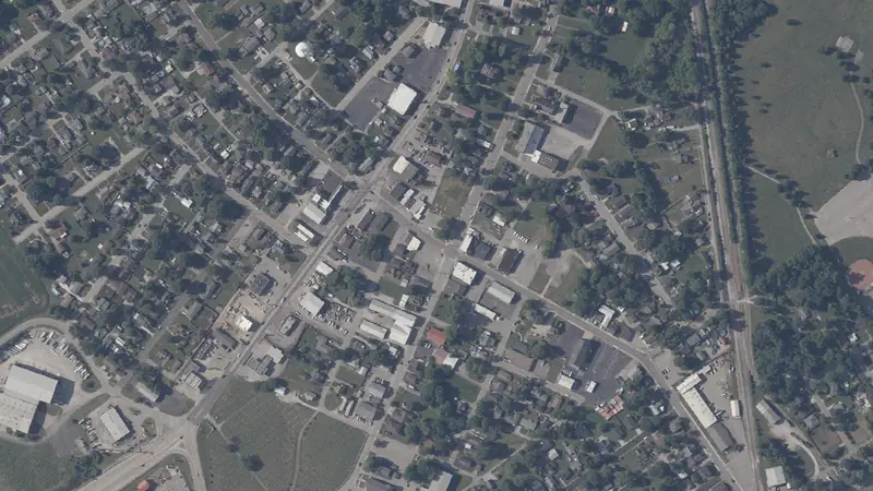
The outline and its edge lengths are measured on the parcel map the map draws; the aerial loads from the public imagery named under it.
Source
Indiana DLGF parcel roll (Indiana Gateway) and IGIO statewide parcel boundaries, county file Sep 1, 2025.
Record
Public records can be wrong; check before you act.
Parcel: 101708900204000031
Coordinates: 38.3855° N, 85.7505° W