Home on 0.12 acres near West Palm Beach, Palm Beach County
Last sold May 2021 for $247k.
10744 Grande Blvd, West Palm Beach, FL 33412 · Parcel 74414213030000030
County roll Jan 1, 2026 · Map data Nov 1, 2026
- WorthJust value $435,502 (2026 roll) · last sold May 2021 for $247,000 · land nearby $205k per lot median, 65 salesPalm Beach County tax roll, 2026 roll · deed record, May 2021 · land sales Nov 2023–May 2026
Sell-for (est.) Hidden: Pro only. See the price with ProPro
Start Pro, $10 a monthCancel any time. Refund policy · Compare plans
- BuildZoning RPD: rules not on filePalm Beach County zoning map, read Oct 2026
- FloodOutside FEMA's high-risk flood zone; no wetlands mappedFEMA flood map, Sep 2026 · NWI wetlands, Sep 2026
- SewerPublic sewerFL DOH Water Management Inventory (2014)
- Home1,970 sq ft · built 2000
- Acres0.12
- Land typeHomeSingle-family home
- ZoningRPDPlanned development
- Future land usePCHomes
- Flood zoneXMinimal flood hazard
- WetlandsNone mappedNational Wetlands Inventory
Land facts
City limits, Urban service area and 12 more
From public records and official maps, each with its source and date.
- City limitsInside the City of West Palm Beach: city zoning and permits applyWest Palm Beach zoning map · Oct 2026
- Urban service areaIn urban service areaPalm Beach County's urban service boundary · Nov 2026
- Section, township, rangeSection 24, Township 42 South, Range 41 East, Tallahassee MeridianBLM PLSS (CadNSDI), at the parcel's center · Oct 2026
- Impact feesCounty impact fees apply here too; the city may add its ownPalm Beach fee schedule · Jan 2026
- SewerConnected (City of West Palm Beach)FL DOH Water Management Inventory (2014)
- WaterPublic (City of West Palm Beach)FL DOH Water Management Inventory
- SoilsRiviera fine sand, 0 to 2 percent slopesHydric (wetland) soils cover 86% of it · USDA soil survey (SSURGO) · Nov 2026
- Ground elevationAbout 20 ft above sea levelUSGS 3DEP 1/3 arc-second (about 10 m), NAVD88; about ±1–2 ft · Nov 2026
- HighwaysSR 710 2.2 mi; Florida's Turnpike Exit 107 4.9 miOpenStreetMap roads · Nov 2026 · straight line
- Nearest fire stationWest Palm Beach Fire Rescue Station 8, 0.3 miUSGS National Structures Dataset · Oct 2026 · straight line
- Nearest emergency roomPalm Beach Gardens Medical Center, 7.7 miCMS Care Compare hospital list · Jul 2026 · straight line
- Nearest public schoolsPierce Hammock Elementary, 3.4 mi · Western Pines Community Middle, 4.7 mi · Palm Beach Gardens High, 6.8 miNCES EDGE 2024-25 · straight line
- Evacuation and surgeNot in an evacuation zone or a storm surge zoneFDEM Know Your Zone evacuation zones · Sep 2026; FDEM storm surge zones (SRES) · May 2022
- Design wind speed164 mph; wind-borne debris regionNIST WindMaps ASCE 7-22 Risk Category II (FBC 2023) via Palm Beach County GIS · Dec 2023
Legal description and record
Parcel number, Legal description and 2 more
- Parcel number74414213030000030Palm Beach County Property Appraiser's record number
- Legal descriptionIBIS GOLF & COUNTRY CLUB PL 18Florida DOR tax roll · 2026 roll · the roll keeps 30 characters; the deed has it all
- SubdivisionIbis Golf & Country Club Pl 18…From the legal
- Lot dimensionsAbout 52 × 102 ft · about 5,350 sq ftCounty parcel map outline · Nov 2026
Services and surroundings
USDA home loan area, Electric service area and 2 more
What serves the area around this parcel, from federal and state maps. Area facts, not a survey of the lot.
- USDA home loan areaOutside the eligible areasUSDA Rural Development map, edited Jul 2023
- Electric service areaLikely Florida Power & Light CoFederal HIFLD map, 2025 copy
- Home electricity priceFlorida Power & Light Co: about 14.6 cents per kWhWhat Florida Power & Light Co's home customers paid on average in 2025, fixed monthly and fuel charges included (home revenue divided by kWh sold). U.S. Energy Information Administration, Form 861, 2025
- Public land nearbyLoxahatchee Slough Natural Area, 0.2 miCounty land, open to the public. 12,948 acres. USGS protected areas map (PAD-US 4.1)
School district
School district
Public federal records, each with its source and date.
- School districtPalm Beach County School DistrictGrades pre-K–12 · NCES EDGE school district boundaries, school year 2024–25 (Census TIGER 2025 lines), released Mar 2026
District details at NCES: Palm Beach County School District
Soil for septic and building
Septic drain field, House, no basement and 2 more
Soils here are rated very limited for a septic drain field. They rate very limited for a house with or without a basement. The main soil shrinks and swells little as it wets and dries.
- Septic drain fieldVery limitedLimits: depth to saturated zone, seepage, bottom layer
- House, no basementVery limitedLimit: depth to saturated zone
- House with basementVery limitedLimit: depth to saturated zone
- Shrink-swellLowLinear extensibility about 0.7% at 10 to 39 in. deep
A soil-survey screening of the parcel's main soil, not a perc test. A septic permit needs the local health department's site evaluation, and a foundation design needs a soil test on the lot.
Free account: this parcel’s sale history
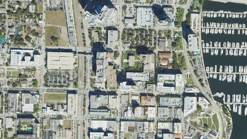 West Palm BeachLand prices, flood and zoning$199kan acre, 2-year median2,304vacant parcels40%in a FEMA flood zone
Road access
Not confirmed
- Not confirmedOpenStreetMap roads
Home facts
Building type, Bedrooms and bathrooms and 2 more
Florida Department of Revenue tax roll · 2026
- Building type
- Single-family
- Bedrooms and bathrooms
- Not on Florida's statewide tax roll
- Living area
- 1,970 sq ft
- Year built
- 2000
Property tax
At least $6,440
Florida Department of Revenue tax roll and millage rates (Data Book), as of Nov 2025
- Property tax (2025)
- At least $6,440Taxable value $333,880 for school levies and $308,158 for other levies on the 2025 roll, after the homestead exemption
Pay or check a bill at the Palm Beach County Tax Collector.
Hazards
Hurricane, Lightning and 6 more
FEMA National Risk Index for this census tract, not this parcel. As of Dec 2025.
- Hurricane
- Relatively high
- Lightning
- Relatively high
- Tornado
- Relatively low
- Strong wind
- Relatively low
- Heat wave
- Relatively low
- Earthquake
- Very low
- Landslide
- Very low
- Coastal flooding
- No ratingNo expected annual loss computed for this tract
Recorded flood claims
Outside FEMA's high-risk flood zone; no wetlands mapped
OpenFEMA NFIP Redacted Claims v3, as of Sep 2026
- Claims since 1978
- 16Insured buildings in this census tract
- Outside the mapped flood zone
- Almost allRated zone X, B or C
Federal disaster declarations
sources & method and 4 more
Federal disaster declarations in Palm Beach County since 2000: 25 (most recently Hurricane Milton, October 2024).
- 19 hurricanes
- 2 biological emergencies (COVID-19)
- 2 severe storms
- 1 freeze
- 1 tropical storm
Development nearby
2020–2025, 2015–2025 and 1 more
About 11 acres within a mile turned from farmland, forest or other open land into developed land in 2020–2025 (more than most of Palm Beach County).
- 2020–2025
- About 11 acresWithin a mile, open land turned developed
- 2015–2025
- About 70 acresThe same, over 10 years
- Typical in Palm Beach County
- Under 5 acresThe middle of the county's land, 2020–2025
Value history
Roll values set for property tax · Florida Department of Revenue tax roll (NAL) · 2026
| Year | Land | Improvements | Just value | Change |
|---|---|---|---|---|
| 2026 | $185,000 | $250,502 | $435,502 | -1.6% |
| 2025 | $200,000 | $242,590 | $442,590 | +26.9% |
Roll values set for property tax · Florida Department of Revenue tax roll (NAL) · 2026
Home values in ZIP 33412 rose about 72% over 5 years and 2% in the last year (FHFA, 2025).
Vacant land prices nearby
$205k per lot
$205k per lot
Median of 65 sales of vacant lots, Nov 2023–May 2026
Sales area: West Palm Beach
| Land type | Median | Middle half |
|---|---|---|
| Vacant lots | $205k/lot | $115k–$835k |
| Other vacant land | $192k/ac | $171k–$213k |
In Palm Beach County, Operator shows unpaid property taxes and code-enforcement records on the parcel when there are any, each dated, with its source. What owner signals are →
Nearby
Median household income, Median home value (owner-reported) and 5 more
- Land-use change, approved1.6 mi
FLUM LGA 2020-002: COCONUT PALM PLAZA RR-20→CL/RR-20…
FLUM LGA 2020-002: COCONUT PALM PLAZA RR-20→CL/RR-20 (11.25ac)
Neighborhood (Census)
Census ACS 2020–2024 5-year, as of Jan 2026
- Median household income
- $131,522± $26,735
- Median home value (owner-reported)
- $581,800± $110,952
- Median rent (gross)
- $2,635± $218
- Homes lived in by their owners
- 62%± 11 pts
- Median year homes were built
- 1998± 2 yr
- Average commute (one way)
- 32 min± 11 min · census tract (not published for block groups)
- Population
- 1,567± 372
Figures for the census block group around this parcel (a few hundred homes), not this property. This product uses Census Bureau data but is not endorsed or certified by the Census Bureau.
Nearby homes
10748 Grande Blvd and 5 more
- 10748 Grande BlvdHome, 0.12 acresunder 0.1 mi
- 10740 Grande BlvdHome, 0.12 acresunder 0.1 mi
- 10736 Grande BlvdHome, 0.12 acresunder 0.1 mi
- 10752 Grande BlvdHome, 0.12 acresunder 0.1 mi
- 10743 Grande BlvdHome, 0.14 acresunder 0.1 mi
- 10732 Grande BlvdHome, 0.12 acresunder 0.1 mi
Sources & methodSources, dates and how the estimates are tested
Soil for septic and building
Source: USDA NRCS soil survey (SSURGO), survey area FL611, version Aug 2026, read through NRCS Soil Data Access.
The parcel's soil map unit: Riviera fine sand, 0 to 2 percent slopes. Its main component is Riviera (80% of the unit).
The ratings are NRCS's own map-unit interpretations (dominant condition): ENG - Septic Tank Absorption Fields, ENG - Dwellings W/O Basements and ENG - Dwellings With Basements. The limits listed are the features NRCS names for the main component. Shrink-swell is that component's linear extensibility, depth-weighted from 25 to 100 cm, the layer NRCS's homesite rule reads; NRCS classes: low under 3%, moderate 3 to 6%, high 6 to 9%, very high 9% or more.
A screening, not a perc test or a soil boring: soils vary inside a map unit (survey scale about 1:12,000 to 1:24,000), and fill or grading may have changed the lot.
Property tax
A minimum: the county-wide and city rates the state publishes times the roll's taxable value. The bill also carries the levies this figure leaves out; the county's bill is the official figure. Excludes levies on part of the county (fire, library and other special districts, unincorporated-area MSTUs) and non-ad valorem assessments.
Property tax · Due dates
Florida 2026 taxes: 4% discount if paid in November; due by March 31, 2027.
Sources: Florida Statutes 197.162, 197.333, 197.222 and 194.011. Checked Oct 13, 2026.
Hazards
Ratings come from FEMA's National Risk Index (v1.20, planning-level) and the public federal and state maps named on each row, not a private climate model. FEMA rates each census tract from expected annual losses, community resilience and social vulnerability, for planning; it is not an assessment of this parcel. No rating: FEMA computed no expected annual loss for this census tract; not a statement about this parcel.
Recorded flood claims
Insured buildings near this parcel, not the parcel itself. FEMA counts claims on buildings with NFIP flood insurance, so land that never had an insured building has no claims to count. The count is the parcel's census block group when it has 10 or more, else its tract's; a count under 10 prints as "Fewer than 10". Source: OpenFEMA NFIP Redacted Claims v3.
Federal disaster declarations
Each federal declaration whose designated areas include the county, declared from January 2000 on, counted once by its FEMA disaster number. An emergency declaration and a major-disaster declaration for the same storm are two declarations, as FEMA numbers them. Declarations for tribal lands alone are not counted. The date shown is when the most recent incident began. Types are FEMA's incident types: an evacuation emergency for a storm elsewhere (Hurricane Katrina, 2005) counts under that storm. By kind: 15 major disasters and 10 emergencies.
Source: FEMA, OpenFEMA Dataset: Disaster Declarations Summaries - v2, as of October 2026. This product uses the Federal Emergency Management Agency's OpenFEMA API, but is not endorsed by FEMA. The Federal Government or FEMA cannot vouch for the data or analyses derived from these data.
Development nearby
Counted from USGS Annual NLCD land cover (USGS Annual NLCD Collection 1.2, 30 m maps made from Landsat imagery, 2015, 2020 and 2025; public domain, DOI 10.5066/P94UXNTS). A 30 m square counts when it was forest, shrub, grassland, pasture, cropland or wetland in the start year and developed in 2025: NLCD's developed classes, from lawns, parks and roads to dense buildings. The squares are summed over the land within about a mile of this parcel's center on a 240 m grid, so the figures are rounded. "Most of the county" compares the same one-mile figure across the county's land. A satellite land-cover map misses some changes and mislabels a few, so read it as a guide to how fast the area is building out, not a survey. As of 2025 land cover.
Value history
This tracks home values, not land values. Land buyers read it as a sign of demand nearby: where homes gain value, builders and buyers follow. A vacant lot can move differently.
How: the change in FHFA's annual five-digit ZIP code index from 2020 and 2024 to 2025, rounded. The index follows repeat sales and refinance appraisals of the same single-family homes with Fannie Mae or Freddie Mac mortgages. It is in today's dollars, not adjusted for inflation, and FHFA calls these local indexes developmental. Where FHFA's sample is too small it publishes no figure, and none prints here.
Source: FHFA House Price Index, all-transactions, annual five-digit ZIP code index, 2025, last updated March 31, 2026. Method: Bogin, Doerner and Larson, “Local House Price Dynamics: New Indices and Stylized Facts”, FHFA Working Paper 16-01.
Neighborhood (Census)
± is the Census 90% margin of error; a figure comes from the larger census tract when the block group's sample is too small.
At a glance: each fact's source and date
Each figure in the grid above, where it comes from and the date of the file or map we read.
Acres: Palm Beach County tax roll (Florida Department of Revenue), 2026 roll.
Land type: Palm Beach County tax roll (Florida Department of Revenue), 2026 roll.
Zoning: Palm Beach County zoning map, read Oct 4, 2026.
Future land use: Palm Beach County land-use map, read Oct 4, 2026.
Flood zone: FEMA flood map, as of Sep 2026.
Wetlands: USFWS National Wetlands Inventory, as of Sep 2026.
Just value (county): Palm Beach County tax roll (Florida Department of Revenue), 2026 roll.
Last sale: Palm Beach County deed record, recorded May 2021.
How each fact is measured
Soils: Soils rate very limited for septic.
Nearest fire station: USGS National Structures Dataset, fire and EMS stations, Oct 2026.
Nearest fire station: Straight line, not road miles. Insurers' fire protection class (ISO) counts road miles to a responding station, often 5 or fewer. A station missing from the federal list would be closer.
Nearest emergency room: CMS Care Compare hospital list (hospitals that report an emergency department), located by the U.S. Census Bureau geocoder, the USGS building or the county parcel record, Jul 2026.
Nearest emergency room: Straight line, not road miles or drive time. Names are the hospital's Medicare listing or its building name on the USGS map. Veterans', military, children's and psychiatric hospitals are not counted.
Nearest public schools: Straight line from the parcel's map point, not road miles. The nearest school is not necessarily the one a home here is zoned for. The school district sets attendance zones, so check with the district. Regular public schools only; charter, online and alternative schools are not counted.
USDA home loan area: Household income limits also apply.
Electric service area: An approximate map: confirm with the utility.
Home electricity price: Your bill depends on your use and rate plan.
Public land nearby: Being nearby does not give access or hunting rights.
School district: A district, not an assigned school.
0.12-acre improved parcel in Palm Beach Gardens West (Avenir), Palm Beach County: zoned RPD, FEMA zone X, no mapped wetlands; vacant lots in West Palm Beach sold for a median of $205k per lot (65 sales, Nov 2023–May 2026). Map data as of Nov 1, 2026.
Land prices
Latest arm's-length sale per vacant parcel (lots of half to twice this lot's size, priced per lot), last three years.
Sources
Public county records: the tax roll, GIS zoning and land use, FEMA flood zones and USFWS wetlands. Map data as of Nov 1, 2026.
Parcel outline
The outline and its edge lengths are measured on the county parcel map the map draws; the aerial loads from the public imagery named under it.
Record
Public records can be wrong; check before you act.
Parcel: 74414213030000030
Coordinates: 26.8093° N, 80.2104° W
Estimates for your own analysis, not an appraisal or a broker price opinion.
Owners
Your land? Ask us to hide your name: confidential records right away, other requests within five business days.