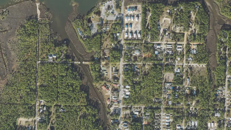
0.41-acre property near Santa Rosa Beach, Walton County
US Hwy 98 W, Santa Rosa Beach, FL 32459 · Parcel 342S20332700010005
County roll Jan 1, 2026 · Map data Oct 28, 2026
At a glance
- BuildZoning Village Mixed Use allows homes · building on the tax roll
- GroundSoils very limited for septic; in a sewer service area, no main at the lot
- AccessRoad access not confirmed
- ValueJust value $398k, 2026 roll · last sale $750k (Aug 2018, with 2 other parcels)
- Acres0.41
- Land typeBuilding on the rollFlorida use code 027
- ZoningVillage Mixed UseVillage mixed use center
- Future land useVMUVillage mixed use
- Flood zoneA on 89% of the lotZone X on the rest
- WetlandsNone mappedNational Wetlands Inventory
Land facts
From public records and official maps, each with its source and date.
- City limitsUnincorporated Walton County: county zoning and permits applyWalton County zoning map · Oct 2026
- Section, township, rangeSection 34, Township 2 South, Range 20 West, Tallahassee MeridianWalton County parcel number · 2026 roll
- Allowed usesHomes, apartments, shops, offices, small lodgingWalton County land development code, LDC Sec. 2.02.23; Sec. 5.00.03 Table 5-1 · Sep 2026
- SewerIn Regional Utilities Sewer territory · no line mappedUtility GIS (Sep 2026)
- WaterIn Regional Utilities Water territory · no line mappedUtility GIS (Sep 2026)
- SoilsHurricane sand, 0 to 5 percent slopesSoils rate very limited for septic · USDA soil survey (SSURGO) · Oct 2026
- Ground elevationAbout 16–17 ft above sea level; average slope 1.2%USGS 3DEP 1/3 arc-second (about 10 m), NAVD88; about ±1–2 ft · Oct 2026
- HighwaysUS 98 203 ft; nearest interstate/expressway interchange 1.8 mi, in a straight lineOpenStreetMap roads · Oct 2026
- Evacuation zoneZone CFDEM Know Your Zone evacuation zones · Sep 2026
- Storm surge zoneCategory 5 storm surge zoneFDEM storm surge zones (SRES) · May 2022
- Design wind speed147 mph; wind-borne debris regionNIST WindMaps ASCE 7-22 Risk Category II (FBC 2023) via Palm Beach County GIS · Dec 2023
- Red flagsContamination site nearby: an environmental review before you buy is worth itGroundwork check of FEMA, USFWS, FWC, FL DEP and EPA layers · Sep 2026
- Just value per acre$971k an acreJust value $398k over 0.41 acres · 2026 roll
Legal description and record
- Parcel number34-2S-20-33270-001-0005Walton County Property Appraiser's form · state roll: 342S20332700010005
- Legal descriptionPARCEL B & PARCEL 1: COM ATFlorida DOR tax roll · 2026 roll
- Lot dimensionsAbout 100 × 176 ft · about 17,550 sq ftCounty parcel map outline · Oct 2026
- DeedOne deed for 3 parcels, Aug 2018Florida DOR sales file · one price for the whole deed
Services and surroundings
What serves the area around this parcel, from federal and state maps. Area facts, not a survey of the lot.
- Electric service areaLikely Choctawhatche Electric Co-op, IncAn approximate map: confirm with the utility. Federal HIFLD map, 2025 copy.
- Public land nearbyPoint Washington State Forest, 0.3 miOther state land, open to the public. 15,024 acres. Being nearby does not give access or hunting rights. USGS protected areas map (PAD-US 4.1).
School district
Public federal records, each with its source and date.
- School districtWalton County School DistrictGrades pre-K–12 · NCES EDGE school district boundaries, school year 2024–25 (Census TIGER 2025 lines), released Mar 2026. A district, not an assigned school
District details at NCES: Walton County School District
Free account: 25 parcel cards a day on the map, with watches and a saved search
 Santa Rosa BeachLand prices, flood and zoning$277kan acre, 2-year median4,869vacant parcels37%in a FEMA flood zone
Road access
- Not confirmed OpenStreetMap roads
Home facts
Building footprints (Microsoft, OpenStreetMap) via Overture Maps, as of Sep 2026
- Buildings
- 1 building mapped · about 2,010 sq ft of footprint Measured from building footprints (Microsoft/OpenStreetMap, Sep 2026), not the county roll
- Bedrooms and bathrooms
- Not on Florida's statewide tax roll
- Living area and year built
- Not on Florida's statewide tax roll for this parcel
Property tax
Florida Department of Revenue tax roll and millage rates (Data Book), as of Nov 2025
- Property tax (2025)
- At least $2,150 Taxable value $398,200 for school levies and $128,519 for other levies on the 2025 roll
How we compute this
Pay or check a bill at the Walton County Tax Collector.
Due dates
Hazards
FEMA National Risk Index for this census tract, not this parcel. As of Dec 2025.
- Hurricane
- Very high
- Lightning
- Very high
- Tornado
- Relatively high
- Coastal flooding
- Relatively moderate
- Strong wind
- Relatively moderate
- Heat wave
- Relatively moderate
- Earthquake
- Very low
- Landslide
- Very low
How we compute this
Recorded flood claims
OpenFEMA NFIP Redacted Claims v3, as of Sep 2026
- Claims since 1978
- 11 Insured buildings in this census block group
- Outside the mapped flood zone
- Fewer than 10 Rated zone X, B or C
How we compute this
Value history
| Year | Land | Improvements | Just value | Change |
|---|---|---|---|---|
| 2026 (preliminary) | $398,200 | Not on the roll | $398,200 | No change |
| 2025 | $398,200 | Not on the roll | $398,200 | +84.1% |
Roll values set for property tax · Florida Department of Revenue tax roll (NAL) · 2026
Vacant land prices nearby
$210k per lot
Median of 206 sales of off-water vacant lots, Oct 2023–Jun 2026
Sales area: Santa Rosa Beach
| Land type | Median | Middle half |
|---|---|---|
| Off-water vacant lots | $210k/lot | $125k–$475k |
Nearby
Neighborhood (Census)
Census ACS 2020–2024 5-year, as of Jan 2026
- Median household income
- $172,069 ± $51,352
- Median home value (owner-reported)
- $871,000 ± $155,885
- Median rent (gross)
- $2,210 ± $196 · census tract (block group sample too small)
- Homes lived in by their owners
- 100% ± 0 pts
- Median year homes were built
- 1998 ± 3 yr
- Average commute (one way)
- 24 min ± 8 min · census tract (not published for block groups)
- Population
- 1,282 ± 388
Figures for the census block group around this parcel (a few hundred homes), not this property. This product uses Census Bureau data but is not endorsed or certified by the Census Bureau.
How we compute this
Nearby homes
- 3099 W US Hwy 98Home, 0.33 acresunder 0.1 mi
- 3063 W US Hwy 98Home, 0.86 acresunder 0.1 mi
- 3197 W US Hwy 98Home, 0.72 acresunder 0.1 mi
- 3223 W US Hwy 98Home, 4.45 acresunder 0.1 mi
- 111 N Co Hwy 393Home, 2.13 acresunder 0.1 mi
- 3170 US Hwy 98 WHome, 3.12 acres0.1 mi
About these numbersSources, dates and how the estimates are tested
0.41-acre improved parcel in Santa Rosa Beach, Walton County: zoned Village Mixed Use, 89% in FEMA zone A, no mapped wetlands; off-water vacant lots in Santa Rosa Beach sold for a median of $210k per lot (206 sales, Oct 2023–Jun 2026). Map data as of Oct 28, 2026.
Land prices
Latest arm's-length sale per vacant parcel (lots of half to twice this lot's size, priced per lot), last three years.
Sources
Record
Parcel: 342S20332700010005
Coordinates: 30.3734° N, 86.2301° W
Estimates for your own analysis, not an appraisal or a broker price opinion.
Owners
Your land? Ask us to hide your name: confidential records right away, other requests within five business days.