5.18 acres of commercial land near Leland, Brunswick County
Parcel 0210007707
County file May 2026
- Acres5.18
- Land typeVacancy not verifiedNo building found, May 2026
- ZoningLE-C-1
- Future land useIndustrial
- Flood zoneX
- Wetlands8% of the parcel
- Tax value (county)$242kFrom the county’s last revaluation, not a market price
- Last saleNo priced sale on file (as of May 2026)Brunswick County publishes no sale prices we may use
- Road accessHas road accessRoads: US Census TIGER/Line 2026 roads, as of 2026-10-06
- Road frontage749 ft on Andrew Jackson Hwy NE
- BuildingNone on the roll
- Who zones itInside the Town of Leland limits
Land facts
From public records and official maps, each with its source and date.
- Septic (soils)Very limitedUSDA NRCS soil survey (SSURGO), septic absorption fields · Oct 2026
- Ground elevationAbout 51–60 ft above sea levelUSGS 3DEP 1/3 arc-second DEM, NAVD88; about ±1–2 ft · Apr 2026
Services and surroundings
Public federal and state records, each with its source and date. Area facts, not a survey of this parcel.
- State-maintained roadYes: US 74 · Andrew Jackson Hwy NENCDOT state-maintained roads, Jun 2026
- Traffic countAbout 35,700 vehicles a dayUS 74, 2024 average daily count for the road segment, not the driveway (FHWA Highway Performance Monitoring System)
- Public land nearbyNorth Carolina Agricultural Foundation Preserve, 2.5 miOpen with restrictions (permit or registration), 533 acres (USGS PAD-US 4.1). Nearby is not access, and never a hunting right
School district
Public federal records, each with its source and date.
- School districtBrunswick County SchoolsGrades pre-K–12 · NCES EDGE school district boundaries, school year 2024–25 (Census TIGER 2025 lines), released Mar 2026. A district, not an assigned school
District details at NCES: Brunswick County Schools
Utility service areas
Public service-area maps, each with its source and date. An area, not a connection at this parcel.
- Electric service areaInside the service area of Duke Energy Progress (approximate)Investor-owned utility · HIFLD electric retail service territories, frozen 2025 copy, edited Aug 2025; approximate, confirm with the utility
Free account: 25 parcel cards a day on the map, with watches and a saved search
 LelandParcels, flood and zoning6.9%in a FEMA flood zone$370ktypical home tax value17,582parcels on the roll
North Carolina 2026 taxes: due since September 1; pay by January 5, 2027 to avoid interest. Pay or check a bill at the Brunswick County Tax Office.
Sources: N.C. General Statutes 105-360 and 105-322. Checked Oct 13, 2026.
Value history
May 2026: $242,280 ($242,280 land)
Roll values set for property tax · NC OneMap parcels (county files) · as of May 2026
Hazards
FEMA National Risk Index v1.20, planning-level · For this census tract, not this parcel · as of Dec 2025
- Hurricane
- Very High
- Winter weather
- Relatively High
- Riverine flooding
- Relatively Moderate
- Tornado
- Relatively Moderate
- Strong wind
- Relatively Moderate
- Heat wave
- Relatively Moderate
- Wildfire
- Relatively Moderate
- Coastal flooding
- Relatively Low
- Earthquake
- Relatively Low
- Landslide
- Very Low
Ratings are from public federal and state maps (named on each row), not a private climate model. FEMA rates each census tract from expected annual losses, community resilience and social vulnerability, for planning; it is not an assessment of this parcel.
Recorded flood claims
OpenFEMA NFIP Redacted Claims v3 · Insured buildings near this parcel, not the parcel itself · as of Sep 2026
- Claims since 1978
- 37In this census tract
- Outside the mapped flood zone
- 35%Rated zone X, B or C
- Largest event
- Hurricane Florence2018, 18 claims
Neighborhood (Census)
Census ACS 2020–2024 5-year · as of Jan 2026
- Median household income
- $73,269± $27,079 · this block group
- Median home value (owner-reported)
- $267,400± $27,430 · this block group
- Median rent (gross)
- $1,049± $217 · census tract (block group sample too small)
- Homes lived in by their owners
- 91%± 11 pts · this block group
- Median year homes were built
- 1996± 7 yr · this block group
- Average commute (one way)
- 28 min± 9 min · census tract (not published for block groups)
- Population
- 1,234± 412 · this block group
Figures for the census block group around this parcel (a few hundred homes), not this property. ± is the Census 90% margin of error; a figure comes from the larger census tract when the block group's sample is too small. This product uses Census Bureau data but is not endorsed or certified by the Census Bureau.
Nearby parcels
Land and farm parcels of 1 acre or more in Brunswick County, nearest first.
- 40.7 acres of industrial land near Leland0.3 mi
- 38.1 acres of industrial land near Navassa0.3 mi
- 2940 Andrew Jackson Hwy NE28.5 acres · Industrial lot · 0.3 mi
- 23.6 acres of residential land near Navassa0.4 mi
- 8028 Jefferson Ln NE22.3 acres · Industrial lot · 0.5 mi
- 1031 Oak Canopy Dr6.07 acres · Residential lot · 0.6 mi
- 1031 Terrapin Pkwy63.3 acres · Residential lot · 0.7 mi
- 1615 Malmo Loop Rd NE146 acres · Industrial lot · 1.2 mi
About these numbersSources, county file May 2026
Tax value
Tax value from the county’s last revaluation, not a market price. County file, May 2026.
Tax value (the county's assessed value) as of its last revaluation (NC reappraises every 4-8 years), not a market estimate. Farm and forest land in present-use value is taxed on a lower use value.
Land type
No building found: county roll (2026) and building footprints (Overture Maps with Microsoft and OpenStreetMap, Sep 2026) · County tax roll; Overture Maps 2026-09-23.1
Parcel outline
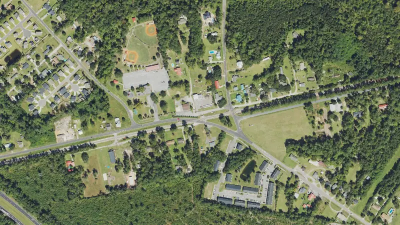
The outline and its edge lengths are measured on the parcel map the map draws; the aerial loads from the public imagery named under it.
Source
NC OneMap statewide parcels (NC CGIA, county data producers), county file May 28, 2026.
Record
Public records can be wrong; check before you act.
Parcel: 0210007707
Coordinates: 34.2699° N, 78.1099° W