3.67-acre residential lot near Pendleton, Madison County
W Angle Rd, Pendleton, IN · Parcel 481421404012000013
County file January 2025
- Acres3.67
- Land typeVacancy not verifiedNo building found: county roll (2025) and building footprints (Overture Maps with Microsoft and OpenStreetMap, Sep 2026) · County assessor roll; Overture Maps 2026-09-23.1
- ZoningGB
- Flood zoneX
- Tax value (county)$7,300From the county’s last revaluation, not a market price
- Last saleNo recorded transfer since 2019 on the county rolls
- Road accessHas road accessCensus TIGER/Line 2025 roads with IndianaMap road centerlines, USGS 3DEP 1/3 arc-second DEM (tiles 2022-08-30 to 2026-09-03)
- Road frontage161 ft on W Angle Rd
- City or townPendleton
Land facts
From public records and official maps, each with its source and date.
- Section, township, rangeSection 21, Township 18 North, Range 7 East, Second Principal MeridianBLM PLSS (CadNSDI), at the parcel's center · Oct 2026
- Septic (soils)Very limitedUSDA NRCS soil survey (SSURGO), septic absorption fields · Oct 2026
- Ground elevationAbout 873–886 ft above sea levelUSGS 3DEP 1/3 arc-second (about 10 m), NAVD88; about ±1–2 ft · Oct 2026
Services and surroundings
Public federal and state records, each with its source and date. Area facts, not a survey of this parcel.
- USDA home loan areaInside an eligible areaUSDA Rural Development eligibility map, last edited Jul 2023, read Oct 2026. Household income limits also apply
- Well depth nearbyMedian 80 ft (middle half 52–112 ft)73 well logs within 1 mi, drilled 1956–2005; water level 16 ft below ground; bedrock at 39 ft (Indiana DNR well records). Area figures, not this parcel
- Public land nearbyFalls Park, 0.8 miCity Land, open to the public, 164 acres (USGS PAD-US 4.1). Nearby is not access, and never a hunting right
School district
Public federal records, each with its source and date.
- School districtSouth Madison Community School CorporationGrades K–12 · NCES EDGE school district boundaries, school year 2024–25 (Census TIGER 2025 lines), released Mar 2026. A district, not an assigned school
District details at NCES: South Madison Community School Corporation
Utility service areas
Public service-area maps, each with its source and date. An area, not a connection at this parcel.
- Electric service areaInside the service area of Town of PendletonMunicipal utility · IURC electric service territories map, edited Aug 2026: a visual aid, not the legal ruling
- Water system areaInside the service area of Ingalls Water Company (EPA modeled boundary)Public water system IN5248012 · EPA public water system service areas, edited May 2026: EPA modeled this boundary, which often differs from the actual one. Not a water line at the lot
Mapped ground hazards
State and federal geologic and well maps, each with its agency and date. Distances are from the parcel's map point; a mapped area is not a finding about this parcel.
- Underground coal mineNone mapped within 1/4 miIGWS: Underground coal mines (IDNR, December 2016), as of Dec 2016. Documented underground coal mines since the 1880s, from IDNR mine maps, to December 2016; outlines approximate
Free account: 25 parcel cards a day on the map, with watches and a saved search
 PendletonParcels, flood and zoning6.7%in a FEMA flood zone3,336parcels on the roll
Home facts
- Bedrooms, bathrooms, living area, year built
- Not on Indiana's statewide parcel roll
- Buildings
- No building footprint mapped here (IGIO 2016-2020 LiDAR)
Property tax
Indiana DLGF pay-2026 certified rates; DLGF 2025 real property roll · as of Oct 2026
- Tax rate
- 25.749 mills (Pendleton Town district: Madison County, Fall Creek Township, Pendleton Civil Town, South Madison Community School Corp, Pendleton Community Public Library, East Central Indiana Solid Waste, pay 2026)
- Estimated annual tax
- ~$150Estimate before exemptions (homestead and other deductions, local income tax credits): the $7,300 gross assessed value × 25.749 mills; capped by the circuit breaker at 2% (residential / farmland) of $7,300
Rates: Indiana DLGF, pay 2026. The estimate is the county's taxable value times those rates, before exemptions; it is not a bill. The county treasurer's bill is the official figure.
Indiana pay-2026 taxes: second installment due November 10, 2026. Pay or check a bill at the Madison County Treasurer.
Sources: Indiana Code 6-1.1-22-9 and 6-1.1-15-1.1; the Department of Local Government Finance due dates. Checked Oct 13, 2026.
Value history
| Year | Land | Improvements | Total | Change |
|---|---|---|---|---|
| 2025 (pay 2026) | $7,300 | None | $7,300 | No change |
| 2024 (pay 2025) | $7,300 | None | $7,300 | +4.3% |
Roll values set for property tax · Indiana DLGF parcel roll · as of Sep 2025
Owner: on the county assessment roll (not shown here) · Request removal
Hazards
FEMA National Risk Index v1.20, planning-level · For this census tract, not this parcel · as of Dec 2025
- Tornado
- Relatively Moderate
- Strong wind
- Relatively Moderate
- Hail
- Relatively Moderate
- Riverine flooding
- Relatively Moderate
- Cold wave
- Relatively Moderate
- Winter weather
- Relatively Moderate
- Heat wave
- Relatively Low
- Lightning
- Relatively Low
- Drought
- Relatively Low
- Earthquake
- Relatively Low
- Wildfire
- Very Low
- Landslide
- Very Low
- Sinkhole area (karst)
- Not in a mapped sinkhole areaAt the parcel's map point · Indiana Geological and Water Survey, sinkhole areas (Misc. Map 65) · as of Oct 2026
Ratings are from public federal and state maps (named on each row), not a private climate model. FEMA rates each census tract from expected annual losses, community resilience and social vulnerability, for planning; it is not an assessment of this parcel.
Recorded flood claims
OpenFEMA NFIP Redacted Claims v3 · Insured buildings near this parcel, not the parcel itself · as of Sep 2026
- Claims since 1978
- Fewer than 10In this census tract
Neighborhood (Census)
Census ACS 2020–2024 5-year · as of Jan 2026
- Median household income
- $94,205± $28,006 · this block group
- Median home value (owner-reported)
- $252,100± $26,860 · this block group
- Median rent (gross)
- $911± $160 · this block group
- Homes lived in by their owners
- 88%± 7 pts · this block group
- Median year homes were built
- 1994± 7 yr · this block group
- Average commute (one way)
- 23 min± 5 min · census tract (not published for block groups)
- Population
- 1,603± 315 · this block group
Figures for the census block group around this parcel (a few hundred homes), not this property. ± is the Census 90% margin of error; a figure comes from the larger census tract when the block group's sample is too small. This product uses Census Bureau data but is not endorsed or certified by the Census Bureau.
Nearby parcels
Land and farm parcels of 1 acre or more in Madison County, nearest first.
- 2.05 acres of residential land near Pendleton0.7 mi
- 3.1 acres of residential land near Pendleton1.3 mi
- 3.58 acres of residential land near Pendleton1.3 mi
- 3.49 acres of residential land near Pendleton1.3 mi
- 10 acres of residential land near Pendleton1.5 mi
- 2.79 acres of residential land near Pendleton1.6 mi
- 2.72 acres of residential land near Pendleton1.8 mi
- 2.62 acres of residential land near Pendleton1.8 mi
About these numbersSources, county file January 2025
Tax value
Tax value from the county’s last revaluation, not a market price. County file, January 2025.
Gross assessed value (the county assessor's market value-in-use, trended every year), not a market estimate. Farmland is assessed by the state's base-rate formula, well below what farmland sells for.
Parcel outline
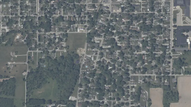
The outline and its edge lengths are measured on the parcel map the map draws; the aerial loads from the public imagery named under it.
Source
Indiana DLGF parcel roll (Indiana Gateway) and IGIO statewide parcel boundaries, county file Jan 1, 2025.
Record
Public records can be wrong; check before you act.
Parcel: 481421404012000013
Coordinates: 39.9921° N, 85.7343° W