2.34-acre lot in the farm and timber tax class near American Canyon, Napa County
Parcel 059020043000
County file October 2026
At a glance
- BuildZoning TC: rules not on file
- Ground12% wetlands · soils very limited for septic
- AccessFronts a public road
- ValueAssessed value $65.6k · no priced sale on file (as of Oct 2026)
- Acres2.34About 2.07 of 2.34 acres outside mapped wetlands and floodway
- Land typeFarm and timber
- ZoningTCTown center
- Flood zoneX · minimal flood hazard
- Wetlands12% of the parcelNational Wetlands Inventory
- Assessed value (county)$65.6kProp. 13 value, not a market price · county file October 2026
- Last saleNo priced sale on file (as of Oct 2026)We have no sale-price file for Napa County yet
- Road accessHas road accessRoads: US Census TIGER/Line 2026 roads, Oct 2026
- Road frontage373 ft on Watson Ln
- Who zones itInside the City of American Canyon limits; American Canyon sets the zoning
- Zoned byAmerican Canyon
Land facts
From public records and official maps, each with its source and date.
- Section, township, rangeSection 13, Township 4 North, Range 4 West, Mount Diablo MeridianBLM PLSS (CadNSDI), at the parcel's center · Oct 2026
- Septic (soils)Very limitedUSDA NRCS soil survey (SSURGO), septic absorption fields · Oct 2026. Inside the City of American Canyon limits: a soil rating, not a sewer check; ask the city whether a sewer main serves the lot
- Ground elevationAbout 116–130 ft above sea level; average slope 5.9%USGS 3DEP 1/3 arc-second (about 10 m), NAVD88; about ±1–2 ft · Oct 2026
- HighwaysBroadway St is 0.5 mi away and I-80 interchange is 3 mi away, in a straight lineUS Census TIGER/Line 2026 roads · Oct 2026
- Property tax floor (Prop 13)At least $586 a year on the 2026 roll1% of the $65,599 assessed value, less the $7,000 homeowners' exemption if it applies; voter-approved bond rates and special assessments come on top; a lower bound unless the roll carries a veterans', welfare or other exemption · California Constitution art. XIII A (Prop 13); homeowners' exemption, Rev. & Tax. Code 218
Services and surroundings
What serves the area around this parcel, from federal and state maps. Area facts, not a survey of the lot.
- USDA home loan areaInside an eligible areaHousehold income limits also apply. USDA Rural Development map, edited Jul 2023.
- Well depth nearbyMedian 150 ft (middle half 100–200 ft)From 27 household well logs within 2 mi, drilled 1962–2026; water level 25 ft below ground. Area figures, not this parcel. California DWR well completion reports.
- Public land nearbyMain Street Park, 0.9 miCity land, open to the public. 70 acres. Being nearby does not give access or hunting rights. USGS protected areas map (PAD-US 4.1).
School district and farmland
Public federal records, each with its source and date.
- School districtNapa Valley Unified School DistrictGrades K–12 · NCES EDGE school district boundaries, school year 2024–25 (Census TIGER 2025 lines), released Mar 2026. A district, not an assigned school
- Farmland classPrime farmland if irrigatedMap unit Clear Lake clay, drained, 0 to 2 percent slopes, MLRA 14, most of the parcel · USDA NRCS soil survey (SSURGO), survey area CA055, version Sep 2026
- Crop productivity (NCCPI)0.45 of 1National Commodity Crop Productivity Index 3.0 of the main soil, Clear Lake; higher is more productive for non-irrigated commodity crops · USDA NRCS soil survey (SSURGO), version Sep 2026
- Land capability classClass 3s of 8: severe limits for crops (shallow, droughty or stony soil)Non-irrigated, Clear Lake; class 1 has the fewest limits · USDA NRCS soil survey (SSURGO), version Sep 2026
District details at NCES: Napa Valley Unified School District
Crops and forest
Public federal records, each with its source and year. Satellite classifications, not farm records.
- Land cover (CDL)Grass or pasture 2023–2025; developed (open space) 2022; grass or pasture 2021No crop in these years; the most common class in the 90 m around the parcel's map point, from satellite imagery · USDA NASS Cropland Data Layer 2021–2025
- Hydric soils95% of the parcelShare of the outline on soils rated hydric: the soil test of a wetland determination and of an NRCS wetland reserve easement (ACEP-WRE) · USDA NRCS soil survey (SSURGO)
Utility service areas
Public service-area maps, each with its source and date. An area, not a connection at this parcel.
- Electric service areaInside the service area of Pacific Gas & Electric Co. (approximate)Investor-owned utility · HIFLD electric retail service territories, frozen 2025 copy, edited Aug 2025; approximate, confirm with the utility.
- Water system areaInside the service area of City of American CanyonPublic water system CA2810005 · Boundary not yet verified by the State Water Board · California State Water Board water system area boundaries, edited Oct 2020. Not a water line at the lot.
Environmental records
Public state and federal lists, each with its agency and date. Distances are from the parcel's map point; a record is not a finding about this parcel.
- Red flags7 environmental lists checked · Water Board cases opened after January 2023 not checkedGroundwork check of public lists: U.S. EPA, as of Oct 2026; California Department of Conservation, Geologic Energy Management Division (CalGEM), as of Oct 15, 2026; U.S. Fish and Wildlife Service, as of Aug 31, 2026; USGS Gap Analysis Project, as of 2025; California Department of Toxic Substances Control (DTSC), as of Oct 17, 2026; California State Water Resources Control Board, as of Jan 26, 2023
- Oil and gas wellsNone within 1/4 mi of the parcel's map pointGroundwork check of public lists: California Department of Conservation, Geologic Energy Management Division (CalGEM), as of Oct 15, 2026
Mapped ground hazards
State and federal geologic and well maps, each with its agency and date. Distances are from the parcel's map point; a mapped area is not a finding about this parcel.
- Young faults (USGS)Nearest fault trace USGS maps as active in the last 15,000 years within about 1 mi of the parcel's map point (West Napa fault, latest Quaternary fault)USGS: Quaternary Fault and Fold Database (historic and latest-Quaternary faults), read Oct 2026. USGS Quaternary Fault and Fold Database traces, mapped at 1:24,000 to 1:250,000; positions approximate. Not a state fault-zone (Alquist-Priolo) determination
Free account: 25 parcel cards a day on the map, with watches and a saved search
 American CanyonParcels, flood and zoning273vacant-coded on the roll, not verified0.5%in a FEMA flood zone5,734parcels on the roll
Property tax
California Constitution art. XIII A (Prop 13) and the county assessment roll · 2026
- Tax rate
- About 1% of assessed value plus local voter-approved rates
- If you buy
- About 1% of the price you pay each year, plus local voter-approved ratesProp 13 resets the assessed value to the purchase price at a sale
How we compute this
Pay or check a bill at the Napa County Treasurer-Tax Collector.
Due dates
Value history
Current roll (Oct 2026): $65,599 ($65,599 land)
Roll values set for property tax · Napa County assessment roll · as of Oct 2026
Who decides
- City or countyInside the City of American Canyon's limitsThe City of American Canyon sets zoning, ADU and SB 9 rules.California Department of Technology city boundaries · Sep 21, 2026
Assessed value (Prop 13)
- $65,599The county does not publish the base yearIn California this is not a market value. Under Prop 13 it starts at the purchase price and rises at most 2% a year, so long-held property is usually assessed far below what it would sell for. We don't have tested sale data for this county, so we don't show a price estimate.Napa County (ODC-PDDL)
Zoning
- TC (American Canyon's own code), state class “Planned area”. As of Q1 2022, collected from REST (county). Verify with American Canyon: the state's classes are generalized.LCI California Zoning (New Classes), release Jan 15, 2026 · Q1 2022
- General planNot shown: the state's map here is Napa County's, and the parcel is inside the City of American Canyon's limits. Check with the City of American Canyon.LCI California General Plan Land Use · Q2 2022
Housing
- SB 35 / SB 423 streamliningCheck HCD's current determination for American Canyon: the only map layer HCD publishes is its June 2023 determination, HCD has determined again since (June 2025), and under SB 423 a city or county without a compliant housing element must streamline projects with 10% affordable units. A possible streamlined site is not evaluated here.HCD SB 35 / SB 423 determinations · Jun 23, 2023 · Official map
- Opportunity mapCTCAC/HCD opportunity area: Moderate Resource (used for tax-credit housing).CTCAC/HCD Opportunity Map 2026 · 2025-12
Fire
- Fire Hazard Severity ZoneIn a mapped Moderate Fire Hazard Severity Zone (CAL FIRE Fire Hazard Severity Zone map, State Responsibility Area, effective Apr 1, 2024; and Fire Hazard Severity Zone map, Local Responsibility Area, dated Mar 24, 2025). Local Responsibility Area maps take effect when the city or county adopts them by ordinance, and the adopted map can differ from CAL FIRE's; check with the City of American Canyon.CAL FIRE Fire Hazard Severity Zones · SRA Apr 1, 2024; LRA Mar 24, 2025 · Official map
Groundwater
- Not over a DWR Bulletin 118 groundwater basin; well rules here come from the county.DWR Bulletin 118 (2025), SGMA basin priority (2019), Groundwater Sustainability Agencies · B118 2025; SGMA priority 2019; GSA layer read Oct 11, 2026
Check before you buy
- Earthquake fault zone (Alquist-Priolo)Check the California Geological Survey's official Earthquake Zones of Required Investigation map.Official map
- Liquefaction / landslide zoneCheck the California Geological Survey's official Earthquake Zones of Required Investigation map. Many areas have not been evaluated by the state.Official map
- Williamson Act contractCheck with the county assessor or planning department whether the parcel is under a Williamson Act contract.Official map
- Conservation easementNone in PAD-US 4.1 easements (USGS Gap Analysis Project, as of 2025) at this parcel's map point. PAD-US does not carry every easement or habitat plan: check CCED and the city or county too.USGS Gap Analysis Project · 2025 · Official map
- Historic propertyCheck with the City of American Canyon: no statewide layer lists historic landmarks and districts.No statewide layer
- Tenants and rent controlCheck with the City of American Canyon: tenancy and rent control are not in any public map.Not in public data
Owner: on the county assessment roll (not shown here). Request removal
Data: Napa County (ODC-PDDL)
Governor's Office of Land Use and Climate Innovation (LCI), California Zoning (New Classes). Zoning from the State of California's statewide zoning layer, provided as a public service for informational purposes only; it is not legal advice. Each jurisdiction's own zoning map governs.
Governor's Office of Land Use and Climate Innovation (LCI), California General Plan Land Use. General plan land use from the State of California's statewide layer, for informational purposes only; not legal advice. The jurisdiction's adopted general plan governs.
California Department of Housing and Community Development (HCD), SB 35 statewide determination. HCD's determination for the jurisdiction as published; a project's eligibility for streamlining is decided by the jurisdiction.
California Tax Credit Allocation Committee (CTCAC) and HCD, 2026 Opportunity Map. Used by CTCAC to score tax-credit housing applications; it describes the census tract, not the parcel.
California Department of Technology, California city boundaries (from CDTFA / BOE). City limits as compiled by the state for tax administration; the city and county confirm jurisdiction.
Hazards
FEMA National Risk Index for this census tract, not this parcel. As of Dec 2025.
- Riverine flooding
- Very high
- Earthquake
- Relatively high
- Wildfire
- Relatively high
- Landslide
- Relatively moderate
- Drought
- Relatively moderate
- Heat wave
- Relatively low
- Strong wind
- Very low
- Coastal flooding
- No ratingNo expected annual loss computed for this tract
How we compute this
Recorded flood claims
OpenFEMA NFIP Redacted Claims v3, as of Sep 2026
- Claims since 1978
- Fewer than 10Insured buildings in this census tract
How we compute this
Neighborhood (Census)
Census ACS 2020–2024 5-year, as of Jan 2026
- Median household income
- $143,646± $29,560 · census tract (block group sample too small)
- Median home value (owner-reported)
- $931,600± $46,371 · census tract (block group sample too small)
- Median rent (gross)
- $2,613± $244 · census tract (block group sample too small)
- Homes lived in by their owners
- 89%± 10 pts
- Median year homes were built
- 1963± 11 yr
- Average commute (one way)
- 34 min± 8 min · census tract (not published for block groups)
- Population
- 494± 198
Figures for the census block group around this parcel (a few hundred homes), not this property. This product uses Census Bureau data but is not endorsed or certified by the Census Bureau.
How we compute this
Nearby parcels
Land and farm parcels of 1 acre or more in Napa County, nearest first.
- 160 acres of residential land near American Canyon1.1 mi
- 170 acres of residential land near American Canyon1.2 mi
- 268 acres of industrial land near American Canyon2.2 mi
- 207 acres of residential land near Napa2.3 mi
- 1710 American Canyon Rd247 acres · Residential lot · 2.6 mi
- 85.5 acres of residential land near Napa2.7 mi
- 103 acres of industrial land near Napa5.4 mi
Land and farm parcels of 1 acre or more in Napa County: 479 parcel pages
About these numbersSources, county file October 2026
Assessed value
Assessed value (Prop. 13), not a market price. County file, October 2026.
Assessed value $65,599 (the county does not publish the base year). In California this is not a market value. Under Prop 13 it starts at the purchase price and rises at most 2% a year, so long-held property is usually assessed far below what it would sell for.
Parcel outline
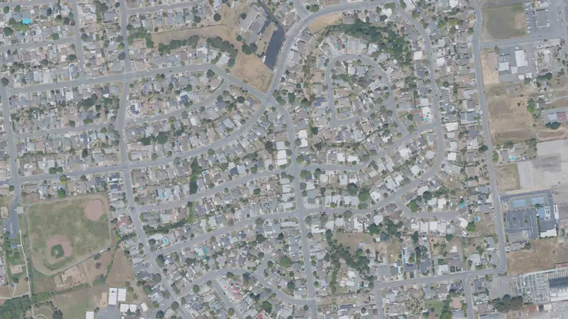
The outline and its edge lengths are measured on the parcel map the map draws; the aerial loads from the public imagery named under it.
Source
Napa County (ODC-PDDL), county file Oct 11, 2026.
Record
Public records can be wrong; check before you act.
Parcel: 059020043000
Coordinates: 38.1932° N, 122.2469° W